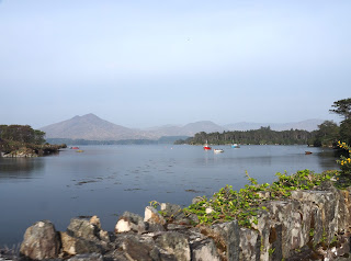
The weather is much better today but everything is pretty
hazy. However, there is much to see so
we are off after breakfast to drive a small part of the 1500 miles of the Wild
Atlantic Way, including the Ring of Beara.
Our first stop was Timoleague...
to visit the Timoleague Friary. Founded in 1300 it was used well until the early 1600’s when Queen Elizabeth I decided to minimize the Catholic presence in Ireland. It is mostly ruins now…
to visit the Timoleague Friary. Founded in 1300 it was used well until the early 1600’s when Queen Elizabeth I decided to minimize the Catholic presence in Ireland. It is mostly ruins now…
and has been used until recently as a cemetery.
We also stopped at the small Church of Ireland nearby.
This church is well known for its mosaics that cover almost all of the interior walls. We haven't seen many mosaic walls in churches.
And there was a verrrrrryy steep ladder that is used to go up into
the belfry.
When we arrive the ladies of the church were just bringing in flowers to decorate the church for upcoming Easter services.
The Wild Atlantic Way follows the coast line from Kinsale in the South to the Inishowen Peninsula in Ulster on the north coast. We will travel it as much as possible but will likely not be able to see nearly all of it. Today we saw cliffs and beaches and beautiful coastline and more interesting villages.
The Wild Atlantic Way follows the coast line from Kinsale in the South to the Inishowen Peninsula in Ulster on the north coast. We will travel it as much as possible but will likely not be able to see nearly all of it. Today we saw cliffs and beaches and beautiful coastline and more interesting villages.
We also stopped at the Drombeg Stone Circle, an Iron Age
stone circle on a beautiful hillside overlooking the hills and coastline. The circle was in good condition and not that
big. The best part was the gorgeous
location.
There were a lot of stone "fences" between the fields in the area.
From there we headed on to Bantry where we had lunch. There was a local flea market going on so parking was pretty limited.
From there we headed on to Bantry where we had lunch. There was a local flea market going on so parking was pretty limited.
We eventually hit the Ring of Beara. Beara is one of several
peninsulas on the west coast, another of which is Kerry…the Ring of Kerry is
one of the major tourist drives in Ireland…we will be doing that later.
Stops on the Ring of Beara included Castletownbere…
and at the very tip of the peninsula we had views of Drusey
Island. There is a cable car that one
can take to the island. There are a few
farms on the island and only a few semi-permanent residents. The island is known for its hiking trails and bird
watching. The channel between the
mainland and the island looked to have pretty treacherous currents.
From there we headed back going along the northern coast of
the peninsula. We stopped to take a few
pictures of some rainbow sheep…they all seem to have been spray painted,
probably for identification purposes.
We hit a bit of “traffic” when we came across some farmers
moving a small herd of cattle down the road.
Too fun!
Parts of this area look very different from the green fields
we have seen elsewhere. Some of the
mountains in the area lack much in the way of vegetation. At one time copper was discovered and mined
in this area.


No comments:
Post a Comment